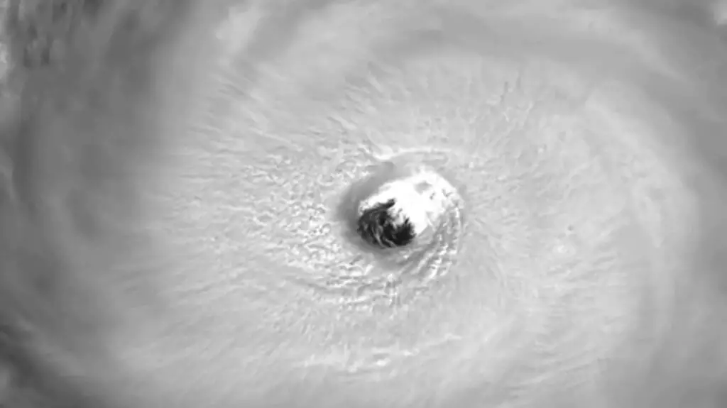
This impressive footage shows the clear eye of destructive hurricane Ian as it rages through the Caribbean coastline and it has now reached a speed of 155 miles per hour.
The superstorm started off as Tropical Storm Ian when it formed on 23rd September 2022, and kept tracking east across the Caribbean Sea for several days.
This footage obtained by Newsflash from the Cooperative Institute for Research in the Atmosphere (CIRA), located at the Colorado State University, USA, offers a unique view inside the centre of what is the impressive and devastating force of nature that is now Hurricane Ian.
Ian strengthened into a hurricane early on 26th September, according to CIRA.
The hurricane reportedly began rapidly intensifying and by the following day it became a category two storm with maximum sustained winds of 100 mph.
Early on 27th September, Hurricane Ian strengthened to a category three, a major hurricane just prior to making landfall in western Cuba, CIRA said.
As Hurricane Ian re-entered open waters, this time over the Gulf of Mexico, the storm began quickly re-intensifying.
On the morning of 28th September, Ian became a category four hurricane with maximum sustained winds of 155 miles per hour, states CIRA’s newest update on the storm.