Story By: Lee Bullen,Sub Editor: Michael Leidig,Agency: Central European News
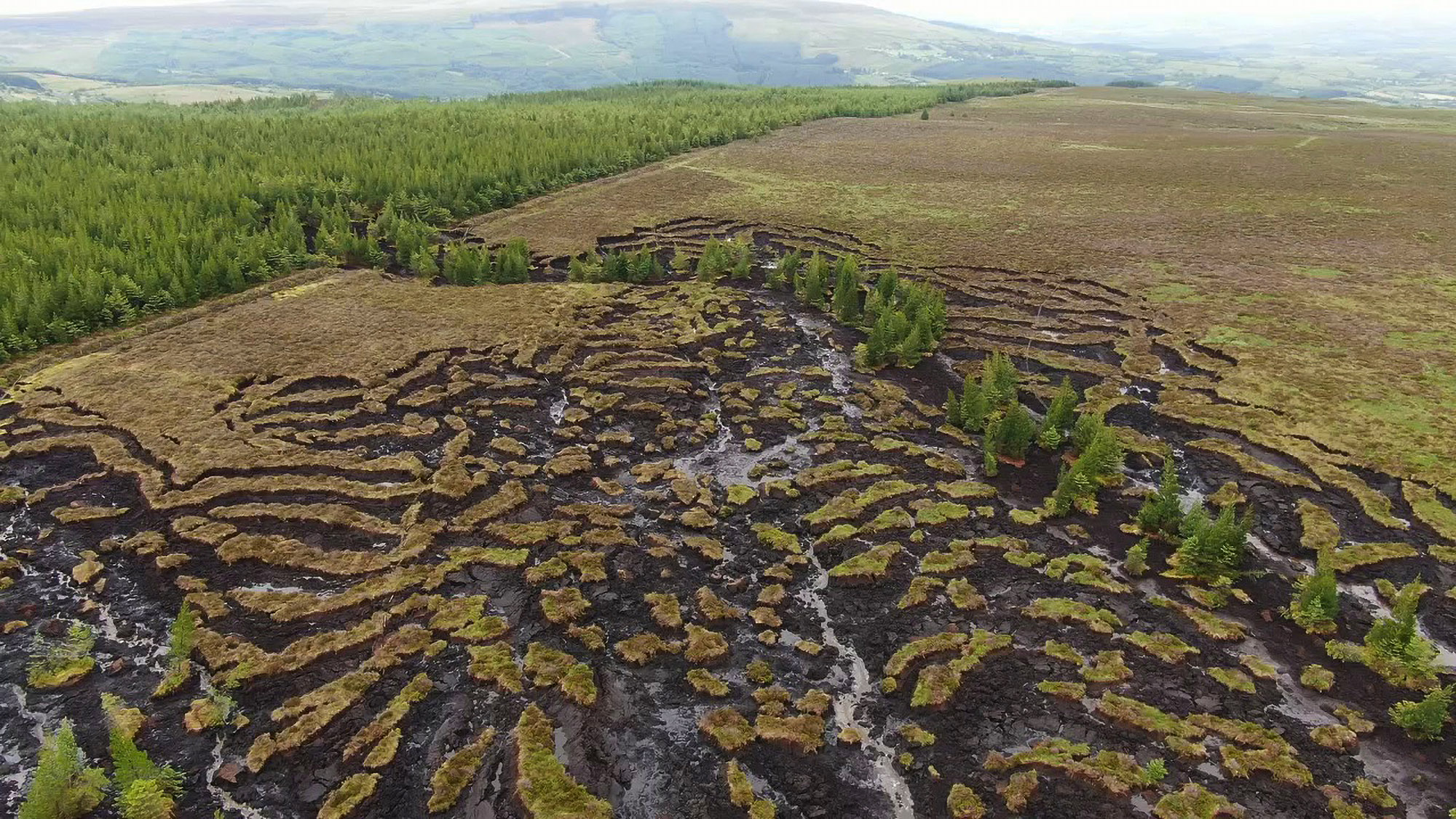
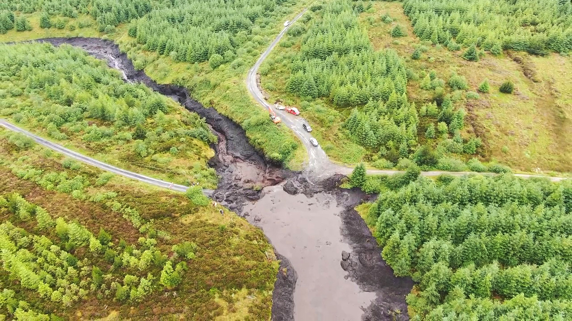
This drone footage shows an aerial view of the devastation caused when large swathes of an Irish bog were washed downhill, dumping thousands of tons of soil onto farms and roads.
The mudslide hit an area above the Dawn of Hope Bridge near the village of Drumkeeran in the Irish county of Leitrim, and engineers monitoring the damage said that around 12 farms were affected.
Tommy Drugan, chairman of the Irish Farmers’ Association in Drumkeeran, likened the scenes to something straight “out of a movie”.
He said thousands of tons of boggy earth slipped off the mountain and “came down into a river”.
Drugan added: “There would be a dozen farmers impacted and there would be five or six family homes where people had to move out because they were afraid to stay there at night because of the dangers of the bog coming in and demolishing their houses.
“You’d have to see it to believe it.”
Drone footage shared on Facebook by netizen ‘John Flynn’ shows the extent of the mudslide and a number of fields, farms and roads affected.
Leitrim County Council engineer Terence McGovern said that the recent sunny weather led to the bog drying out.
A deluge of peat then slipped off the mountain on Sunday evening, according to McGovern.
The local council said that they are still surveying the damage and will advise residents accordingly.
A spokesperson said: “Through this monitoring, should emergency actions be identified, appropriate actions will be carried out.”